Profile
Dedicated GIS Specialist with a Master's in Applied Geography and a focus on indoor occupancy estimation using WiFi technology. Seeking a challenging role to leverage technical proficiency, spatial analysis skills, and hands-on experience in advancing GIS.
Back to homepageProjects
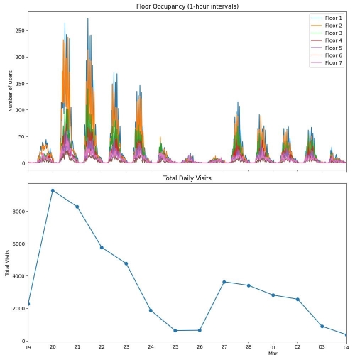
Indoor Wi-Fi Occupancy Analysis
- Leveraged Python to process, anonymize (Faker), filter (Pandas), and visualize (Matplotlib) Wi-Fi logs of a large multi-story building to estimate indoor occupancy.
- Implemented a novel method of Wi-Fi floor-level occupancy analysis using user-role data.
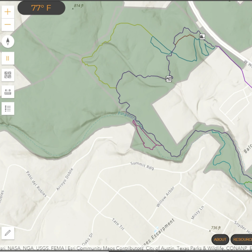
Find Your Path
- Developed an interactive web map using the ArcGIS JavaScript API to assist users in finding hiking trails.
- Feature for users to input trail issues/hazards to a hosted feature layer, enhancing trail maintenance efforts.
- Integrated a Weather API to provide current conditions and cumulative rainfall totals for judging trail health.
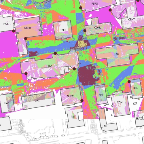
Transpropagation
- Developed a Python-based ArcGIS tool for modeling line-of-sight outside wireless signal propagation.
- With the use of the Friis Transmission Equation, the tool outputs the expected signal coverage and signal power providing insights into the effectiveness of the placement of outdoor wireless access points.
Work Experience
GIS Specialist
Texas State University
February 2014 - Present
- Manage, design, and maintain fiber optic and telephony OSP infrastructure using GIS (M4 solutions).
- Coordinate and advise new OSP construction, cable pulls, and fiber splicing.
AutoCAD Technician
Texas State University
August 2012 – February 2014
- Create diagrams of OSP enclosures and communication rooms using AutoCAD.
- Georeference diagrams using Raster Design and imported them into M4 solutions.
GIS Intern
Hays Environmental Consulting
June 2012 – September 2012
- Generated topographic maps from LiDAR, and assisted in residential facility plans and septic design.
Education
Texas State University, San Marcos, TX
Master of Applied Geography, GIS, December 2023
Relevant Coursework: Geocomputation, Web Mapping, GPS and GPS, GIS II
Texas State University, San Marcos, TX
Bachelor of Science, Geography – Water Studies, December 2013
GIS and Environmental Interpretation Certificates
Christian-Albrechts-University, Kiel, Germany
Project manager of a team-based study abroad, June 2013